Blogs
Five Key Land Surveying Tools in 2025
Land surveying is one of the most important fields that have greatly benefited and grown from modern technological developments. This, along with the following land surveying tools, ensures that in 2025, every surveyor can be productive and accurate while delivering high-quality work. These tools improve data collection productivity, workflow and results in construction and the environment.
They revolutionize the world of oil and gas services and have a profound developmental impact on the industrial and technological environment.

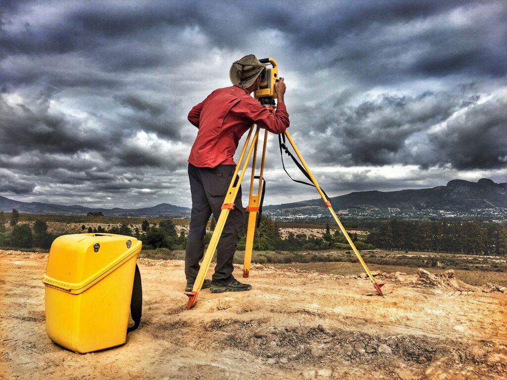
1- GNSS Receivers: Mastering High-Precision PositioningThe advantages of using GNSS receivers in the field of surveying are providing high-quality geographic data, mastering geographic positioning, and creativity in drawing maps with high accuracy and excellent quality as a result of integrating devices with multiple satellite systemsRTK corrections ensure accuracy and mastery.Ensuring maximum speed, which leads to increased productivityProviding many survey-related tasks with the highest accuracy.2- 3D Scanners:Data collection will not be the same as before with 3D scanners that have changed the world of data collection as they have revolutionized the world of surveying and data collection
For surveyors abroad, 3D scanning has become a daily use with these selected devices, as important behavioral data is captured with extreme accuracy and at unparalleled speeds, providing information that facilitates decision-making3. Drones for aerial surveying – expanding coverageWe are working to expand coverage using drones efficiently to complete land surveying and study on a large scale due to their relatively low operating costs and the quality of information production. These drones record engineering and geographic information with high accuracy and high-quality detailsTheir pivotal role is to reach difficult areas for appropriate mapping.They increase the accuracy of surveys, saving the time required to perform field work.They provide the necessary support for monitoring and data transfer at the present time.4- Total measurement stations: Total measurement systemsThey are considered one of the most important devices because they achieve the preferred goals in land surveying due to the ease of measuring angles and distances with them compared to other toolsThey work on integrated electronic distance measurement (EDM) with the capabilities of the angle measuring device.
5- GIS programs: Enhancing data management
GIS programs are a breakthrough in the world of managing and analyzing survey areas. The system allows surveyors to visualize, interpret and manage spatial data accurately, which helps in making the best decision
Ease of processing large amounts of geospatial data.
Providing the appropriate decision by increasing mapping and modeling capabilities.
Works efficiently with other surveying devices.Integrating Geotechnical Survey Systems with Oil & Gas ServicesIntegrating geotechnical survey systems with oil & gas services has become vital for the accuracy and precision of geotechnical services during the exploration and extraction phases as well as during the development of supporting infrastructure. These tools not only enhance geographic accuracy, but also help reduce costs and improve efficiency. Some examples show how geotechnical technologies are transforming the industry:Integrating Land Survey Systems with Oil & Gas Services
Marine survey systems provide adequate soil information for land surveys in oil and gas fields. GEI services ensure that qualitative and quantitative assessments are conducted prior to any action. These assessments include screening of potential hazard areas, abnormal environmental verification, and deformation scenarios. For the specific purpose of identifying risks, the phenomena in question must revolve around potential, which if exploited would lead to economic distortion and development decline.

Key Benefits of Geotechnical Soil Analysis for Oil & Gas Projects
1- It abstractly identifies the subsurface, showing the phenomenon of cavity deformation, magmatic eruption, flooding, and disintegration along many faults.2- Enhances the division of foundations for oil and gas facilities, pipelines, oil refineriesAnd engineering the cooling normalization in underground structures, large bulk tanks, and security elevations3. Capture 3D images and measure oil and gas operating facilities using modern tools
For the development of the oil and gas industryThe future vision of marine surveying
Marine surveying has witnessed a long boom through the involvement of artificial intelligence and through this data, surveyors achieve accuracy, efficiency and innocence based on data that will witness record numbers in various industriesConclusion
Marine surveying has witnessed a development in light of technological development and its coupling with artificial intelligence, which has led to the provision of more accurate data in all branches, which has helped surveyors make appropriate decisions through high-resolution data, accurate mapping and other services that will lead to development in the field of oil and gas recently
