Blogs
The Future of Marine Survey Technology
The rapid advances in marine survey technology and the transformation of the oil and gas industry are accompanied by the expansion of offshore exploration and the need for advanced geotechnical services to meet industry standards. Oil and gas service companies are developing new technologies and the new development in modern marine survey services for oil and gas is increasing the quality of decisions made and the level of risk taken.
It is important to be aware of the changes in marine surveying
The blog discusses the most important changes that will affect the future of marine surveying.
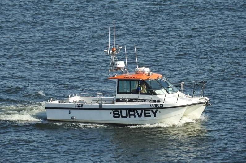
Modern Geotechnical Services:Geotechnical exploration is pivotal in the offshore oil and gas sector because it provides information about the characteristics of the seabed. New technologies in geotechnical exploration services allow for the measurement of soil properties and environmental parameters and contribute to more accurate mapping of the seabed
Marine survey companies will use geotechnical environmental services to ensure safety in construction and drilling activities.
Geophysical sensors improve the collection and verification of underwater data
Geological data is rapidly analyzed through artificial intelligence
As a result, through advanced geotechnical services
Offshore oil and gas companies maximize the extraction of resources with the least possible damage to nature
Artificial Intelligence and Automation in Marine Surveys
Data interpretation and processing in marine surveys are based on the introduction of artificial intelligence. Artificial intelligence-enhanced marine field service programs improve productivity and enhance the operational capacity of field service. Future AI models of the seabed are given and workflows are improved
Seismic and sonar data are analyzed using machine learning algorithms. AI-powered remotely operated vehicles are taking over underwater exploration activities
Image management systems are changing and decision-making is easier in marine activities.
AI in marine activities is helping to reduce reliance on costs and increase profit margins.Remotely operated vehicles (ROVs) and autonomous underwater vehicles (AUVs) are used in marine surveys.
Remotely operated vehicles (ROVs) and autonomous underwater vehicles (AUVs) have qualified to conduct deep-sea surveys without the need for human elements, as they can monitor more than oil and gas service centers by collecting data.
Robotic operated vehicles perform high-quality video inspections to inspect underwater buildings.
Autonomous underwater vehicles use devices such as sonar and professional imaging to be able to know all the information about the seabed.
Hybrid ROV-AUV systems provide autonomous functions:
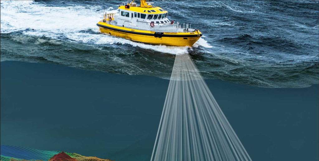
Drones and satellite imaging are spreading to improve the efficiency of remote marine surveys while enhancing the safety of dangerous tasks.
Using satellite imaging and drones, it is possible to conduct remote ocean surveys, which provides a lot of information.
Geospatial mapping technologies enhance the efficiency of oil and gas field service programs by providing real-time data.
Using drones to image coastal and offshore installations and other structures in great detail
Satellite remote sensing detects new processes occurring in the ocean.
Exploration of marine resources and monitoring of development become more efficient with the help of GPS and GIS tools.
Marine surveyors can improve the efficiency and quality of oil and gas operations through the use of satellites and dronesMarine surveying is undergoing new developments with the use of geospatial technologies, supported by satellite and drone imagery. This helps provide additional data for the analysis of water bodies and other marine features. The data provided adds value to existing oil and gas field service programs.Important coastal and marine structures such as ports and buoys are developed and documented by drones using aerial photography.Ocean variables are monitored and detected by remote sensors onboard satellites.GPS and GIS are used to manage and capture marine activities by enhancing the exploration of marine resources in the region.By combining satellite and drone technology, marine surveyors are significantly improving the accuracy and efficiency of marine technology deployment
Innovations in the fields of offshore field services and offshore oil services will be delivered with creativity and efficiency.High-quality seabed imaging will be enabled by the use of next-generation sensorsArtificial intelligence and automation tools will make marine data processing more efficient and creativeBy leveraging these practices, global and local environmental requirements will also be metBy adopting new technologies, the offshore oil and gas industry will make exploration and production activities safer, more accurate and more creativeConclusion:
The future of marine surveying is largely shaped by artificial intelligence
The rapid development of marine surveying technologies is transforming the oil and gas industry into a clear world that is easy to explore, control its resources, achieve the best results, and provide accurate data based on clear and sound basic information that works to develop the sector as a whole.
